Dataset to: Kranner et al. (2025) "Rhizoliths from a Middle Miocene hypersaline lagoon in the Central Paratethys Sea (late Badenian, Serravallian, Austria)"
| DOI: | https://doi.org/10.57756/b68mkn |
|---|---|
| Creator(s): |
|
| Publication date: | 05 Mar 2025 |
| Publisher: | Naturhistorisches Museum Wien (NHMW) |
| Collections: | Geology & Palaeontology |
| Instrument: | YXLON FF35 CT |
| Resource type: | Dataset |
| Specimen: | NHMW-GEO-2022/0136/0001, NHMW-GEO-2022/0136/0016, NHMW-GEO-2022/0136/0015 |
| License: |

CC BY 4.0 International |
| Tags: | Badenian salinity crisis Central Microfossil Mudflats Paratethys Rhizolith Sea Serravallian |
| Countries: |
|
| Chronology: | Miocene |
| Share: |
|
 https://orcid.org/0000-0001-5307-3420
Abstract
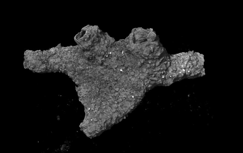
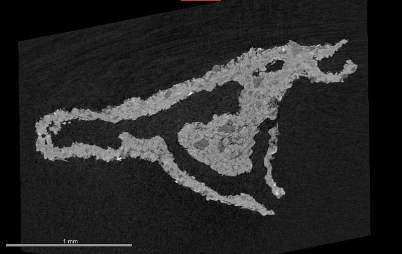
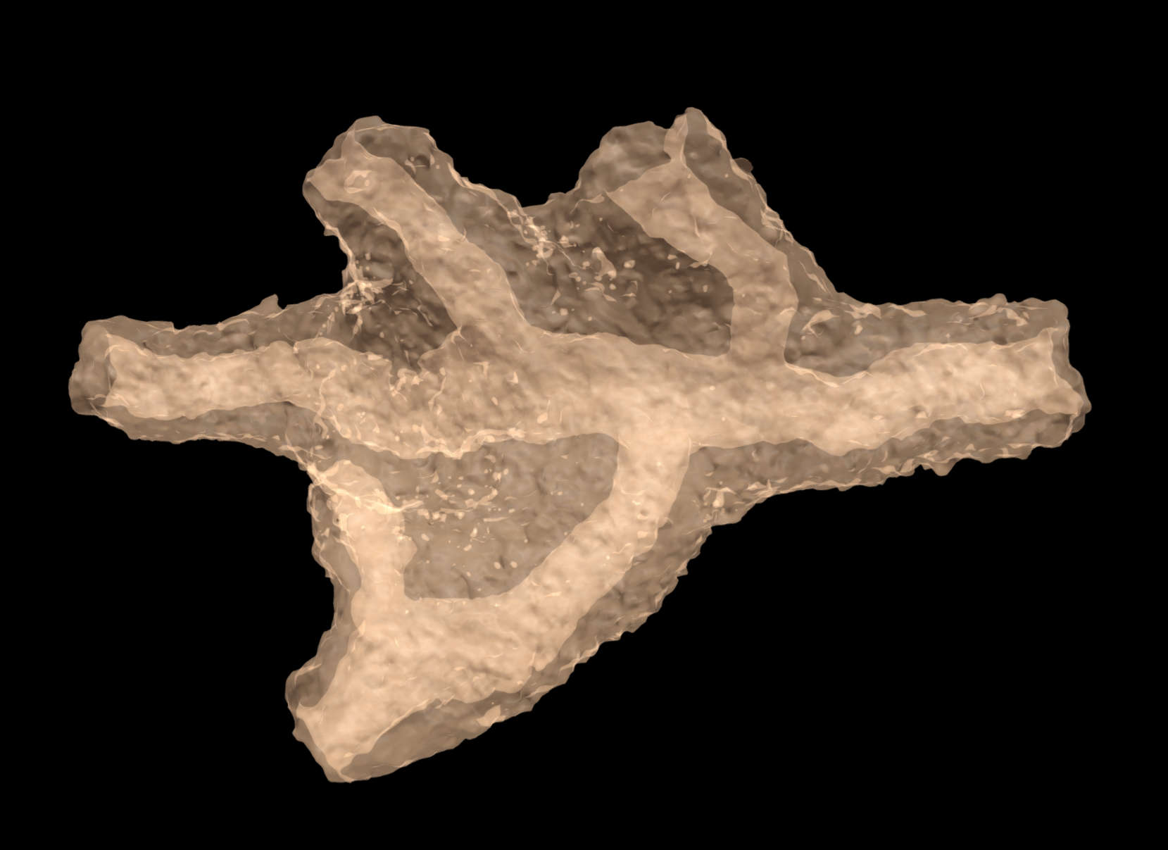
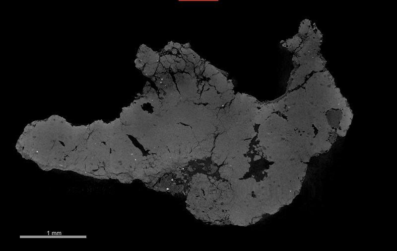
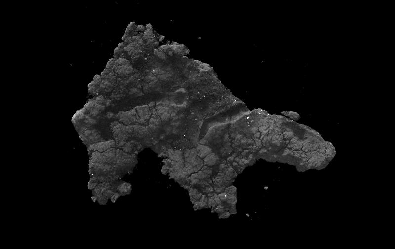
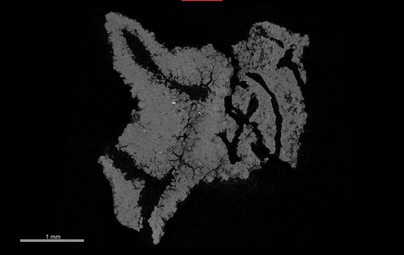
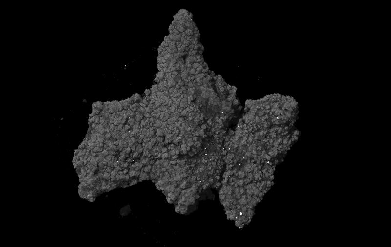
Enigmatic, thick-walled, agglutinated microfossils are described for the first time from the Middle Miocene of Austria. The microfossils are documented in large numbers from the Oberpullendorf Basin in Austria, where they occur in intertidal mudflat deposits associated with an oyster biostrome and in close vicinity to stromatolites. The basin was part of the epicontinental Central Paratethys Sea and was covered by a warm, restricted, hypersaline lagoon, which formed during the Badenian Salinity Crisis at roughly 13.8–13.6 Ma. Widespread evaporite formation characterized the Central Paratethys Sea at that time. Micro-CT scans of the structures reveal morphological features, which suggests that the fossils are rhizoliths, most likely from the rhizolith type 1. The fossils were probably formed by halophilic grasses, or herbaceous plants. The rhizoliths are strikingly similar to agglutinated foraminifera of the family Astrorhizidae and could easily be confused with foraminifera. Extant Astrorhizidae, however, are typically found in offshore deep-sea environments, which is in strong contrast to the ecological requirements of the Miocene Ritzing microfossils. Therefore, despite the morphological similarities, a relation with Astrorhizidae is excluded.
We provide the first detailed morphologic description of fossil rhizoliths from a hypersaline lagoon and assume that they might represent an overlooked feature in coastal deposits of the Proto-Mediterranean Sea and the Paratethys region.
Usage Notes
MicroCT Imaging
MicroCT: YXLON FF35 CT
Detector: Perkin Elmer Y.Panel 4343 CT
X-ray source: FXE Transmission Beam
Voltage: 90 kV
Current: 170 µA
Exposure time: 1s
Scan type: Helix scan
Datasets were cropped and exported as TIFF image stack using ORS Dragonfly version 2022.1.
3D surface models:
All three datasets were segmented in ORS Dragonfly Version 2022.1 and then exported as STL files. Afterwards the surface was smoothed in Blender.
Publications
Kranner, M., Harzhauser, M., & Winkler, V. (2025). Rhizoliths from a Middle Miocene hypersaline lagoon in the Central Paratethys Sea (late Badenian, Serravallian, Austria). Micropaleontology, 71(2), 197-206 https://doi.org/10.47894/mpal.71.2.06
Downloads
| File | Description | Size |
|---|---|---|
| NHMW-GEO-2022-0136-0001-Rhizolith_ReconInfos.xml | Reconstruction parameters (XML) of the microCT scan of a rhizolith (NHMW-GEO-2022-0136-0001) | 0.01 MB |
| NHMW-GEO-2022-0136-0001-Rhizolith_ScanInfos.xml | Scanning parameters (XML) of the microCT scan of a rhizolith (NHMW-GEO-2022-0136-0001) | 0.01 MB |
| NHMW-GEO-2022-0136-0001-Rhizolith_TIF.zip | Image stack (TIF) of the microCT scan of a rhizolith (NHMW-GEO-2022-0136-0001) | 1157.45 MB |
| NHMW-GEO-2022-0136-0001-Rhizolith-MicroCT.stl | 3D surface model of a rhizolith (STL) - NHMW-GEO-2022-0136-0001 | 16.96 MB |
| NHMW-GEO-2022-0136-0015_Rhizolith_MicroCT.stl | 3D surface model of a rhizolith (STL) - NHMW-GEO-2022-0136-0015 | 26.64 MB |
| NHMW-GEO-2022-0136-0015_Rhizolith_ReconInfos.xml | Reconstruction parameters (XML) of the microCT scan of a rhizolith (NHMW-GEO-2022-0136-0015) | 0 MB |
| NHMW-GEO-2022-0136-0015_Rhizolith_ScanInfos.xml | Scanning parameters (XML) of the microCT scan of a rhizolith (NHMW-GEO-2022-0136-0015) | 0.01 MB |
| NHMW-GEO-2022-0136-0015_Rhizolith_TIF.zip | Image stack (TIF) of the microCT scan of a rhizolith (NHMW-GEO-2022-0136-0015) | 3395.05 MB |
| NHMW-GEO-2022-0136-0016_Rhizolith_MicroCT.stl | 3D surface model of a rhizolith (STL) - NHMW-GEO-2022-0136-0016 | 31.26 MB |
| NHMW-GEO-2022-0136-0016-Rhizolith_ReconInfos.xml | Reconstruction parameters (XML) of the microCT scan of a rhizolith (NHMW-GEO-2022-0136-0016) | 0.01 MB |
| NHMW-GEO-2022-0136-0016-Rhizolith_ScanInfos.xml | Scanning parameters (XML) of the microCT scan of a rhizolith (NHMW-GEO-2022-0136-0016) | 0.01 MB |
| NHMW-GEO-2022-0136-0016-Rhizolith_TIF.zip | Image stack (TIF) of the microCT scan of a rhizolith (NHMW-GEO-2022-0136-0016) | 5889.62 MB |
Media
Images